Mountain Bike Bill, Get the Dirt on the Dirt

Black Mountain in Pamo Valley near Ramona

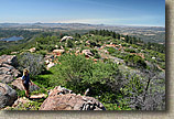
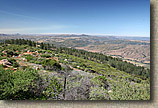
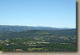
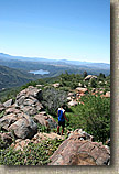
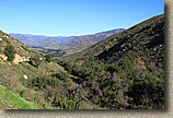
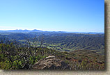
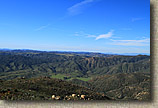
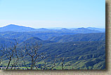
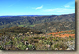
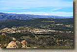
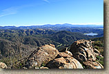
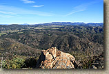
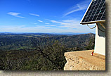
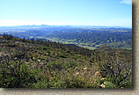
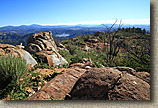
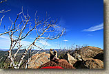
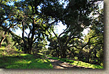
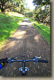
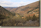
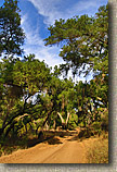
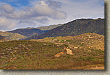
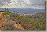
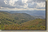
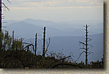
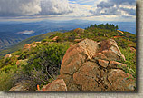
Located north of Ramona on the north-eastern part of the county, Black Mountain is just east of Pamo Valley and west of Mesa Grande. This ride offers some nice fire road riding with a strenuous but manageable climb up to a 4,051' peak with wonderful 360 degree views. There are several of out and back and loop variations that can be done out here that range from 16 to 31 miles. The area was extensively burned in 2007 but has been recovering nicely. A portion of this loop is also part of the Coast To Crest Trail.
Black Mountain Peak

 Directions:

From  LA via I5:  In Oceanside on the I5 south take the 78 east exit.  Follow the 78 into Escondido.  Follow the signs to 78 west as you follow a few city streets. Once through Escondido, continue on the 78 east into Ramona.  At the stoplight (Junction of 67 and 78) turn left to stay on 78 east.  You will go through the town.  At the end of town the road rises over a small hill.  At the bottom of the hill is Magnolia Rd.  Turn left on Magnolia.  Follow Magnolia for about two miles until you reach Pile road.  Park on the side of the road on Pile or Magnolia. 
From San Diego via I15:  Take the Mercy Rd/Scripps Poway Parkway exit.  Turn right onto Scripps Poway Parkway.  After 8.6 miles turn left onto CA-67.  Take CA-67 into Ramona to the junction of CA-78.  Turn left through the town.  At the end of town the road rises over a small hill.  At the bottom of the hill is Magnolia Rd.  Turn left on Magnolia.  Follow Magnolia for about two miles until you reach Pile road.  Park on the side of the road on Pile or Magnolia. 

Map of the AreaBlog Post on Black MountainMap and Resources: The PDF Map to the left is formatted to be printed on legal (8.5" by 14") sized paper.

GPS Files: GDB, GPX, KML, TPO

Use the link to the right to see if I have any blog posts about this area in addition to this page.

Hazards: The truck trails do have some ruts in places.   This area can get really hot in the summer.
Ride Notes: The first time I did this ride was on the 2002 Superbowl Sunday.  I did not like either team in the bowl this year so I decided to get up early and try out this ride.   I had read about it on the mybikesite website and it sounded intriguing.  The review I read was for a 16+ mile loop with an option for a long climb up to the peak of Black Mountain located in the Cleveland National Forest north of the town of Ramona.  I  ended up taking the  "Super Size" option and turned this ride into a 30 miler with 4,821 feet of climbing.  I set off on my ride heading north on Black Canyon road which is still paved at this point.  After about 1.5 to 2 miles the pavement ended and became a graded dirt road.  I did some mild but steady climbing until I reached mile number 4 where I reached a saddle.  There are a couple of trees at this saddle that can be seen from a mile or so away. Think of them as checkered flags if you need some mental help on the climb.

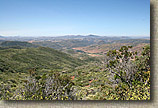
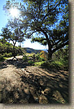
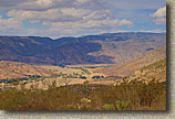
BlackMountainEpic-3FEB02-01-ClimbingBlackCanyonRd-LookingSW.JPG (73891 bytes)The view looking southwest from Black Canyon road as you climb toward the saddle.


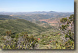
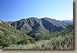
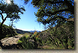
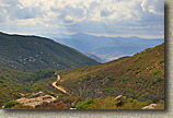
BlackMountainEpic-3FEB02-02-AtSaddleOfBlackCanyonRd-LookingN.JPG (95932 bytes)At the saddle on Black Canyon road you can see the Santa Ysabel Truck trail running along the south side of Black Mountain.  If you look close, at the top of Black Mountain you see a stand of trees.  This route will take you there.


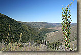
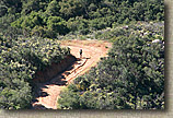
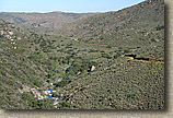
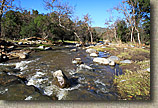
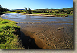
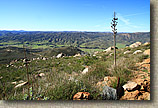
    After the saddle, Black Canyon road started an angling descent to the Santa Ysabel Creek bed.  There were only a few minor ruts in this section of the road which made for  some good speed the descent.  After two miles of downhill rolling I reached the Santa Ysabel Creek bridge at mile 6.  This bridge is designated as a National Historic Bridge as it is one of the oldest bridges in San Diego County being built in 1913. 
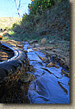
BlackMountainEpic-3FEB02-03-DescendingBCRoad-1.JPG (96105 bytes)    BlackMountainEpic-3FEB02-04-DescendingBCRoad-2.JPG (135338 bytes)    BlackMountainEpic-3FEB02-05-DescendingBCRoad-3.JPG (68515 bytes)    BlackMountainEpic-3FEB02-06-SantaYsabelCreekBridge.JPG (191117 bytes)
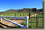
    After crossing the bridge the road bears to the left.  About 75 yards up the road there is a paved road that goes off to the left through a gate.  I dropped down on this road and it quickly rolls into an old campground.  After rolling through the tree shaded campground the road turns left and crosses a small stream at mile 6.4. 
2010 NOTE: A new bridge has been built here. The historic bridge was left intact with the new bridge direcly beside of it.
BlackMountainEpic-3FEB02-07-SYTruckTrail.JPG (131472 bytes)    BlackMountainEpic-3FEB02-08-GateforSantaYsabelTruckTrail.JPG (136680 bytes)    BlackMountainEpic-3FEB02-09-SantaYsabelCampground.JPG (266063 bytes)
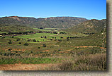
     At this point I am on the Santa Ysabel Truck Trail.  For the next two miles I was climbing but there was enough interspersed downhill sections to keep things interesting and the views were really nice.  This section mostly runs west.  The trees in the saddle of Black Canyon road you past earlier can be seen in the center picture below 
BlackMountainEpic-3FEB02-10-SYTruckTrail-LookingW.JPG (126479 bytes)    BlackMountainEpic-3FEB02-11-SYTruckTrail-LookingSouthAtBCRoadSaddle.JPG (153383 bytes)    BlackMountainEpic-3FEB02-12-SYTruckTrail-SpurTrailToSouth.JPG (156602 bytes)
Santa Ysabel Truck Trail
Here is a panoramic shot taken at mile 8.9 on the Santa Ysabel Truck Trail
    After taking in the views I rolled downhill into a grove of trees at mile 9.3 where the trail splits in two directions.  The three pictures below are of that intersection, looking left, straight, and right respectively.  I do not know where the trail off to the left goes.  If you do please email me.  I have heard that it will eventually take you out to Pamo Valley Road near the bottom of the steep pavement climb (more on that to come) I took the trail to the right which apparently is the Santa Ysabel truck trail still.
BlackMountainEpic-3FEB02-21-BottomOfSYTT-LookingLeft.JPG (181135 bytes)    BlackMountainEpic-3FEB02-19-BottomOfSYTT.JPG (156172 bytes)    BlackMountainEpic-3FEB02-20-BottomOfSYTT-LookingRight.JPG (155327 bytes)

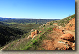
BlackMountainEpic-3FEB02-23-EndofBLKMTNPeakFireRd.JPG (111874 bytes)BlackMountainEpic-3FEB02-22-NearTopOFBLKMTN.JPG (159683 bytes)    At 9.85 miles you climb up to the junction of Black Mountain truck trail (11S04) .  From here I could have hung a left and headed down the mountain and cut the ride short (I'll describe that way a little further down this page) and make it about a 16 miler.  I was feeling up to the the challenge so I hung a right and went for the climb up to the top of Black Mountain.  I kept my camera in the pack for the climb.  For most of the climb I stayed in the middle ring in the front and the top or second cog down on the back.  The truck trail deteriorated the further up the trail I went and the steepest portionswere near the top.  At mile 14.76 I came to the junction of a double track trail off the right. 


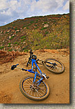
BlackMountainEpic-3FEB02-24-BLKMTN-LookingUpToPeak.JPG (228991 bytes)BlackMountainEpic-3FEB02-39-BLKMTNPeak.JPG (183005 bytes)There was a gate there with a bike around.  I went around this gate and continued  climbing up into a stand  of pine trees.  The pines were put here as part of a  reintroduction project.  The trail was the most technical in this section but it was still fairly tame with loose rock and ruts being the only hurdles. At 15.5 miles I reached the end of the fire road and was greeted with some really nice views.  However, the best views were still a little further on.  There used to be a fire  lookouttower on the peak, but it has since been removed except for the foundation.  It is plain to see that the Forest Service deconstructed the portion of the fire road that went up to the peak. (Middle picture to the left) 

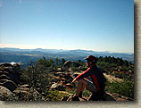
BlackMountainEpic-3FEB02-40-BLKMTPeak-PamoValeyBelow.JPG (414021 bytes)BlackMountainEpic-3FEB02-41-BillOnTopBlackMT.jpg (122285 bytes)This section may some day be a really technical section but at this point it is unrideable unless you have some Hans Rey skills.  So I ditched the bike and hiked up the last two hundred or so yards to the peak at the old lookout tower foundation.   What a view from the peak at 4,091 feet!   It was a beautifully clear day with at full 360 degrees of mountains to look at.  I snapped off a bunch of pictures and broke out a Powerbar and my water bottle for a little snack while fully soaking in the scenery and enjoying the satisfaction of a completely the climb.  

BlackMountainEpic-3FEB02-BlackMoutainPeak-Pan.jpg (117842 bytes)
BlackMountainEpic-3FEB02-BlackMoutainPeak-ShortPan.jpg (165389 bytes)
After I had my fill of the peak I hiked back down to the bike and rolled off down the trail.  On the way down I did stop and take a few pictures.  One thing that was interesting is that up near the top of the mountain I found a small shaded area with a hold out patch of snow from a storm a couple of weeks ago.  Considering that it was in the mid-70s in February, I decided it was picture worthy.  I planned on taking more pictures on the way down, but when you have a 7.5 mile down hill that sheds off over 3,000 feet it is hard too pause the adrenaline rush.  Watching my speed was the name of the game on the way down.  The tricky ruts seemed to pop up in turns and the wash boards really worked my hands over pretty good.
 

BlackMountainEpic-3FEB02-42-BLKMTN-RideDown-Snow.JPG (143635 bytes)BlackMountainEpic-3FEB02-43-BLKMTN-RideDown.JPG (101370 bytes)BlackMountainEpic-3FEB02-45-BLKMTN-RideDown.JPG (163964 bytes)BlackMountainEpic-3FEB02-44-BLKMTN-RideDown.JPG (84805 bytes)

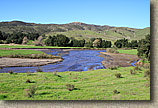
BlackMountainEpic-3FEB02-46-PamoValleyRoad.JPG (172441 bytes)At 21.5 miles I reached the junction of the Santa Ysabel Truck trail again, but this time I just kept on hauling bootie down the Black Mountain Truck trail.  At mile 23 I got down to Pamo Valley road where I hung a left.  Pamo Valley is very picturesque with cattle grazing in pastures framed by oak trees.  I also noticed that there was an exorbitant number of ground squirrels running amuck in the pastures.  It was quite entertaining to watch the squirrels scurry for cover as I approached them.  After about 3 miles of rolling along the mostly flat dirt road it transitions to pavement and starts a  climb that gains 670 feet in 1.7 miles.  Considering all the climbing I had already done and I had already done 26 miles I found this climb to be quite difficult.   There was no middle ringing this hill.  I was in the granny and fighting hard to keep moving.  I made it to the top but my legs were pretty much shot.  After cresting the hill I rolled another 3/4ths of a mile and hung a left at Pile road.  I took Pile road back to the junction of Black Canyon road where my truck was parked.  The total mileage of this ride 29.85 miles!

2005 Ride

Black Mountain 2005images/Trails/BlackMTN/BlackMt-PamoValley-22MAY05-03.jpgOn May 22nd, 2005, I did this ride for a second time.   It just happened to be during our first really hot snap of the year so by the time we started up the main fire road up to the peak it was quite hot out.  It was a much harder climb with the heat than it was during the winter of 2002.  It was still worth the effort as the view from the top were still spectacular.

images/Trails/BlackMTN/BlackMt-PamoValley-22MAY05-19.jpg    images/Trails/BlackMTN/BlackMt-PamoValley-22MAY05-20.jpg    images/Trails/BlackMTN/BlackMt-PamoValley-22MAY05-05.jpg    images/Trails/BlackMTN/BlackMt-PamoValley-22MAY05-06.jpg
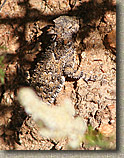
images/Trails/BlackMTN/BlackMt-PamoValley-22MAY05-13.jpg images/Trails/BlackMTN/BlackMt-PamoValley-22MAY05-14.jpg images/Trails/BlackMTN/BlackMt-PamoValley-22MAY05-17.jpg images/Trails/BlackMTN/BlackMt-PamoValley-22MAY05-18.jpgimages/Trails/BlackMTN/BlackMt-PamoValley-22MAY05-HornyToadLizard.jpg

News Year's Day 2011


I decided to start the New Year off with a long solo ride to reflect upon the past year and to get it some quality thinking time about 2011 and beyond. I also decided to do this loop in the opposite direction that I have done in the past. I think I like clockwise direction better than the orginal direction.

Black Mountain 2011Black Mountain 2011Black Mountain 2011Black Mountain 2011Black Mountain 2011Black Mountain 2011

Black Mountain 2011Black Mountain 2011Black Mountain 2011Black Mountain 2011

Black Mountain 2011Black Mountain 2011Black Mountain 2011Black Mountain 2011Black Mountain 2011

Black Mountain 2011Black Mountain 2011Black Mountain 2011Black Mountain 2011Black Mountain 2011

Black Mountain 2011Black Mountain 2011Black Mountain 2011

Post Turkey Day Ride 2016


Some Pictures from a ride up Black Mountain on November 26th, 2016.

BLack Mountain Near Ramona 26NOV16BLack Mountain Near Ramona 26NOV16BLack Mountain Near Ramona 26NOV16BLack Mountain Near Ramona 26NOV16BLack Mountain Near Ramona 26NOV16BLack Mountain Near Ramona 26NOV16

BLack Mountain Near Ramona 26NOV16BLack Mountain Near Ramona 26NOV16BLack Mountain Near Ramona 26NOV16BLack Mountain Near Ramona 26NOV16BLack Mountain Near Ramona 26NOV16